
| Method | |
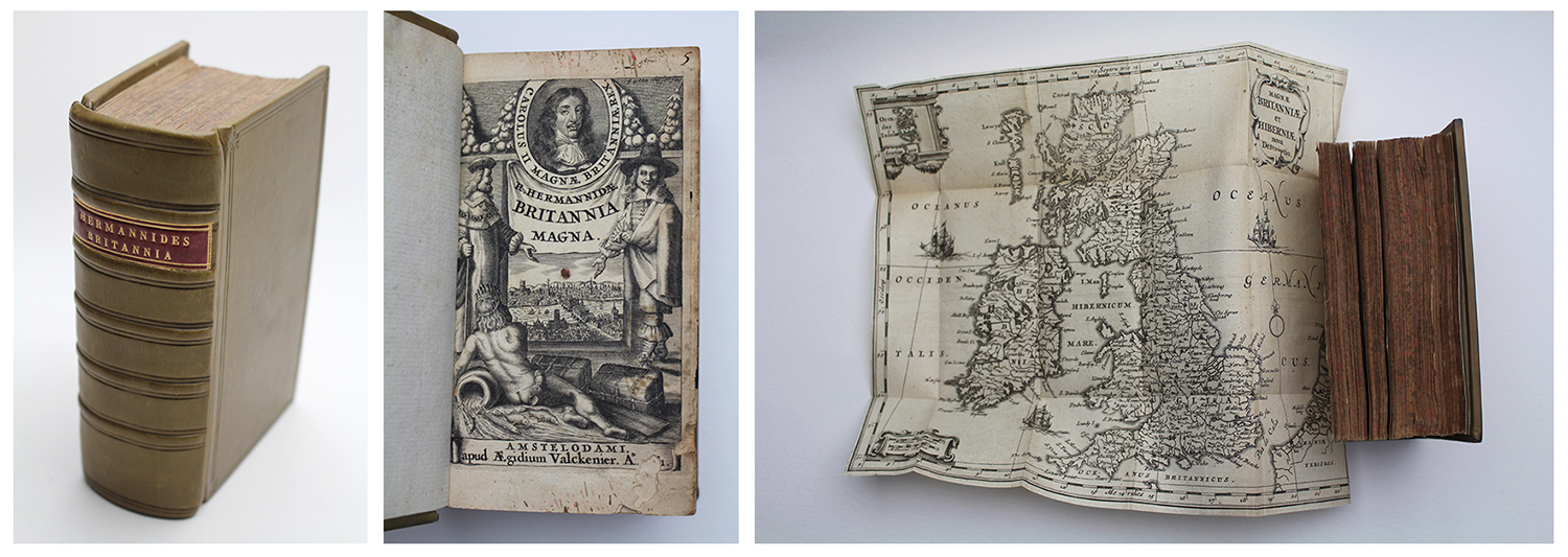
| Artist | Hermannides, Rutger |
| Published | Amstelodami, apud Aegidium Valckenier. A°1661. |
| Dimensions | Duodecimo (12°). 140 x 90 mm |
| Notes |
First edition. Rebound in 20th century tan polished calf, five raised bands, gilt tooled title on red calf label, tooled double fillet on front and back boards and compartments. Engraved additional title page, title page, xxviii, 645pp plus 32 (of 32) interleaved maps, iv, xxxvi (Index). Insect damage to bottom of engraved title, title, and first seven forepages, ink stains and old manuscript annotations to title pages, some wear to folds of maps, minor ink stains to map of London, otherwise clean, crisp, and complete. A fine first edition in Latin of Rutger Hermannides' rare atlas Britannia Magna, published in Amsterdam in 1661 by Aegidius Jansson Valckenier. A commentary on the history and geography of the British Isles, the book is most famous for Hermannides' suite of 32 accompanying engraved maps, featuring a general map of the British Isles and a series of town plans largely based upon the city maps of John Speed. A decorative frontis features a portrait of Charles II in an oval border above a vignette of London, with London Bridge prominent at centre. The vignette is flanked by a pair of figures in the costume of a Lord and a Merchant respectively, and a naked river god, likely representing Father Thames, reclines below. Rutger Hermannides (d.1680) was a Dutch academic, author, and cartographer. A Professor of English at the Guelders Academy, his best known work was Britannia Magna et Hibernia Nova Descriptio, an atlas of the British Isles featuring miniature maps of British cities after John Speed. Wilhelm Serlin (1625-1674) was a German bookseller and publisher, active in Frankfurt from 1649 until his death. |
| Framing | |
| Price | £1,950.00 |
| Stock ID | 52726 |