| Method | Copper engraved with hand colour |
| Artist | de Laporte, Joseph |
| Published | [Paris, c.1780] |
| Dimensions | 180 x 225 mm |
| Notes |
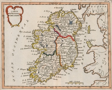
An eighteenth century French map of Ireland, from Joseph de Laporte's Atlas ou Collection de Cartes Geographiques pour l'intelligence du Voyageur Francois. Ireland is divided into its four provinces, with borders outlined in hand colour, and the title is enclosed in a decorative cartouche at top left. Parts of western Scotland, Wales, and England are also shown. Joseph de Laporte (1713-1779) was a French priest, literary critic, poet and playwright. He was a prolific author, though his most famous geographical publication was the 'Atlas ou collection de cartes geographiques pour l'intelligence du Voyageur francois'. Condition: Central vertical fold, as issued. Minor time toning to edges of sheet. Trimmed within platemark to bottom right, as issued, without loss to map. Blank on verso. |
| Framing | unmounted |
| Price | £125.00 |
| Stock ID | 52858 |

