
| Method | Lithograph with hand colour |
| Artist | Lothian, John |
| Published | MacDonald, 31 Argyle St [Glasgow, c.1846] |
| Dimensions | Each 390 x 320 mm |
| Notes |
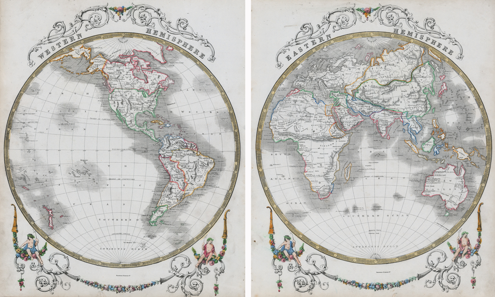
A mid-nineteenth century map of the world in two hemispheres, printed over two sheets, from the uncommon 'Revised People's Atlas' by John Lothian. The maps, showing the eastern and western hemispheres, are presented in outline colour, with decorative swagging and florets surrounding the two roundels. Basic national divisions are shown as dotted lines, and placenames are mostly limited to capital cities. Antarctica is almost completely absent, with a tentative coastline for 'Graham's Land' the only evidence of a landmass aside from a note which reads 'Vast Mountains of Ice.' At the northern pole, Greenland is shown joined to Canada, the coastlines around Baffin's Bay are confused, and modern Alaska is marked as 'To Russia.' John Lothian (1802-1846) was a Scottish publisher, stationer, mapmaker, and geographer. Condition: Minor time toning to edges of sheet. Binders holes along right margin of eastern hemisphere and left margin of western hemisphere, not affecting map. Chips to bottom margins infilled with old repairs. Blank on verso. |
| Framing | mounted |
| Price | £650.00 |
| Stock ID | 52775 |