| Method | Woodcut with hand colour |
| Artist | Munster, Sebastian and Petri, Sebastian |
| Published | c. 1588 |
| Dimensions | 315 x 355 mm |
| Notes |
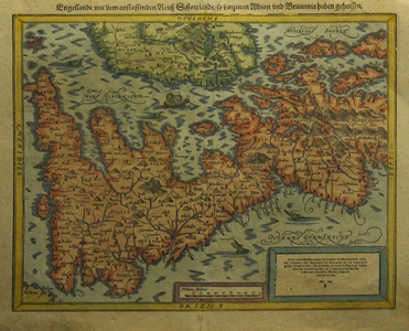
A woodcut map of Britain From the Cosmographia Universalis.is oriented with north to the right following the Mercator/Ortelius outline, with place names, rivers, hills and lakes, and showing the east coast of Ireland. There is a sailing ship, a fishing boat and several sea monsters in the surrounding sea.. Gothic illustration and title on verso. From the Cosmographia Universalis. Munster's Cosmography is one of the most influential geographical works of the 16th Century. Shirley, Early Printed Maps Of The British Isles, 148. |
| Framing | unmounted |
| Price | £600.00 |
| Stock ID | 24041 |

