| Method | Lithograph with original hand colour |
| Artist | Bacon, George |
| Published | Published London: G. W. Bacon & Co., Limited, 127, Strand. 1905 |
| Dimensions | 320 x 500 |
| Notes |
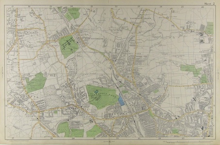
Sheet 2 from Bacon's New Large-scale Atlas of London and Suburbs covering Palmers Green to the North, Hornsey to the South, including Alexandra Park, the East End to the West and Upper Edmonton to the East. The London based book and map seller, George Washington Bacon (1830 - 1922) was prolific during the mid to late 19th century. His company, George Bacon and Co. published many notable atlases, such as The New Ordnance Atlas of the British Isles, based on earlier plates by Edward Weller which Bacon modified. Bacon and Co. bought J. Wyld's map publishing business in 1893, going on to merge with W. & A. K. Johnston at the turn of the 20th century. Bacon was born in New York and emmigrated to England c. 1862. He was intially a London agent for the American atlas publisher Joseph Hitchins Colton. By 1871 he had become a British subject and was living in Battersea with his wife and two daughters. He was described on the Census of 1871 as being a map publisher, employing three men, five boys, and one young lady. Bacon died 21 Jan 1922. Refrences: Worms, Laurence and Ashley Baynton -Williams, British Map Engravers. London, Rare Book Society, 2011. Condition: Vertical centre fold as issued. |
| Framing | mounted |
| Price | £150.00 |
| Stock ID | 41744 |

