
| Method | Steel engraved with original hand colour |
| Artist | Rapkin, John |
| Published | The London Printing and Publishing Company. [c. 1855] |
| Dimensions | 356 x 257 mm |
| Notes |
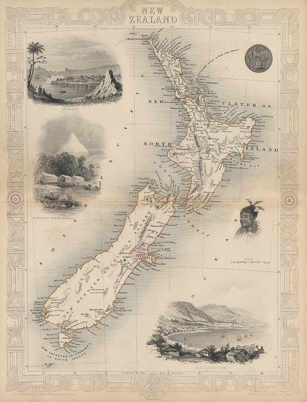
A map of New Zealand engraved by Rapkin for Tallis' popular 'Illustrated Atlas' with original wash and outline colour. Vignettes of Auckland and Wellington, Mount Egmont (known today as Mount Taranaki) as viewed from New Plymouth, a representation of a Maori warrior, and an illustration of a seal surround the map of the North and South Islands, all of which is surrounded by a decorative engraved boarder featuring Maori inspired designs. John Tallis was a British publisher and one of the most popular cartographers of the 19th Century. Tallis maps were highly valued for their accuracy, but perhaps more so for their charming vignettes and ornamentation. Engraved by John Rapkin, these maps were praised by the New York Sun as "the most accurate and most splendid publication of the kind ever issued". The Bristol Times observed that Mr. Tallis maps "are not only critically correct, but are accompanied with elegant and appropriate engravings illustrative of the manners and costumes of the different countries." John Rapkin was an engraver and mapmaker active in Britain in the mid-nineteenth century. He drew and engraved the maps for John Tallis' 'The Illustrated Atlas and Modern History of the World' (1845-51), which was later reissued by the London Printing and Publishing Company. He also drew and engraved maps for R. Montgomery Martin's 'British Colonies, their history' (1849), and Wright's 'Universal Pronouncing Dictionary' (c.1850). Condition: Centrefold as issues and some light toning to sheet. |
| Framing | unmounted |
| Price | £395.00 |
| Stock ID | 53338 |