
| Method | Copper engraved with hand colour |
| Artist | Cluver, Philipp |
| Published | [London, c.1712] |
| Dimensions | 200 x 250 mm |
| Notes |
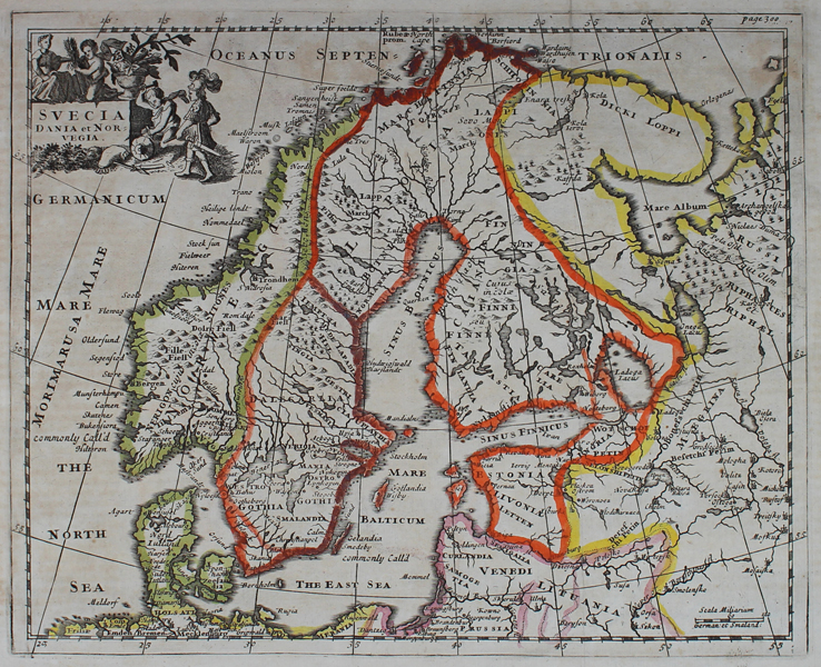
A map of Scandinavia, from an early eighteenth century printing of Philipp Cluver's Introductio in Universam Geographicam. The borders of the various kingdoms and nations of the region are outlined in hand colour and regional titles are given in capitals. Finland, Estonia, and Latvia are shown as part of the Kingdom of Sweden, as is Ingria, despite having been occupied by Russia in 1703. Philipp Cluver (1580-1622) was born in Danzig and after studying at Leyden and Oxford, he became interested in modern and historical geography. His subsequent publications made a wide and influential contribution to knowledge of the subject. Philip Cluver's "Introductonius" was a popular geography book, first published in 1624 without maps. There were many editions throughout the 17th and 18th centuries with maps from several sets of plates. Condition: Vertical folds as issued. Time toning and text offsetting, particularly to margins. Blank on verso. |
| Framing | unmounted |
| Price | £175.00 |
| Stock ID | 48828 |