
| Method | Chromolithograph |
| Artist | [Anonymous] |
| Published | London: G.W. Bacon & Co., Ltd., 127, Strand [c.1890] |
| Dimensions | 1002 x 760 mm |
| Notes |
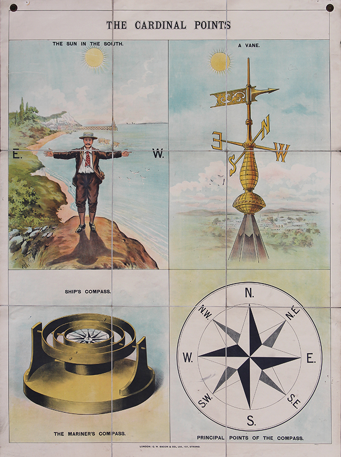
A late nineteenth century folding educational chart illustrating the cardinal points, dissected in nine sheets and laid to linen. Four images demonstrate methods of finding direction: The Sun in the South showing a man in plus fours, a jacket, tie, and boater hat with his arms outstretched, the letter E, for east, at his right hand and the letter W, for west, at his left, with a view based on Scarborough and the sun behind him, A Vane, Ship's compass: The Mariner's Compass, and the Principal Points of the Compass. George Washington Bacon (1830 - 1922) was a prolific London based book and map publisher active in the mid to late 19th century. Bacon was born in New York and emigrated to England c. 1862. He was initially a London agent for the American atlas publisher Joseph Hitchins Colton. By 1871 he had become a British subject and was living in Battersea with his wife and two daughters. He was described on the Census of 1871 as being a map publisher, employing three men, five boys, and one young lady. Bacon died 21 Jan 1922. Bacon's firm G.W. Bacon and Co. produced a wide variety of maps and guides. In 1893, Bacon & Co. acquired the map publishing business of J. Wyld. Then, around the turn of the century, Bacon & Co. itself was folded into the Scottish publishing house of W.& A.K. Johnston. Condition: Dissected and laid to linen in nine sheets as issued. Some over all surface dirt, diagonal crease lower right of sheet, two drawing pin holes top edges of chart, a paint stain and ink mark in Vane picture, ink stain in the Principal Points of the compass, and one small mark in The Mariner's Comapss, otherwise in good bright condition. |
| Framing | unmounted |
| Price | £600.00 |
| Stock ID | 52821 |